What has been confirmed
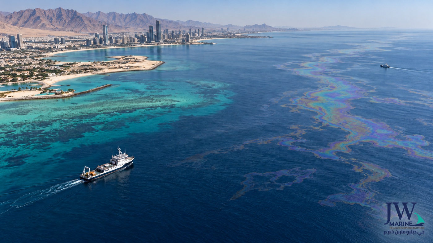
The Ministry of Climate Change and Environment (MOCCAE) said its monitoring and environmental assessment system detected marine pollution from a tanker spill affecting Umm Al Quwain beaches. In its public statement on 22 October, reported the following day, the ministry said odors had been noticed in Sharjah, Ajman and Umm Al Quwain and that these odors posed no health risk to residents. It described containment, cordoning, cleanup and remediation work with local and federal authorities, alongside coastal surveys and continued assessment. The ministry temporarily closed Umm Al Quwain beaches and coastal areas while technical teams assessed conditions and identified protective measures.
That is the official public response described in the contemporaneous reporting. The ministry urged fishermen and other sea users to follow authority instructions and avoid fishing in affected areas. These are location-specific public-safety and environmental directions; anyone at sea should follow the current notice from the competent authority rather than a general blog summary.
On 24 October, The National reported that Ras Al Khaimah had closed its beaches until further notice, and that Sharjah had closed Al Hamriyah Beach as a precaution. On 26 October, Reuters reported that satellite imagery dated 24 October showed the slick had widened. Reuters also said UAE authorities had not publicly named the tanker or confirmed the cause. Experts cited by Reuters associated the slick with a damaged tanker, but that attribution is not the same as an official identification. This article therefore does not name a vessel as the confirmed source.
The difference between a confirmed fact and a developing assessment matters. A coastal closure is not automatically a port closure. An oil slick sighting does not, by itself, confirm a vessel’s port call was cancelled, a channel was restricted, a terminal stopped work, or cargo was contaminated. Those operational conclusions require specific notices from the relevant port, authority, carrier or cargo owner.
What it means for shipping and cargo teams
For a vessel operator, the first question is geographical: where is the spill relative to the intended route, anchorage, pilot station, port limits and any restricted coastal area? Public reports may give a broad location or show satellite imagery, but vessel movement decisions require current navigational warnings and instructions from the relevant maritime authority, port control, agent and master. A news report is not a navigational warning.
The next question is whether an official notice changes the planned call. Operators should check for a notice to mariners, port circular, berth or anchorage instruction, movement restriction, environmental direction, or temporary closure. They should confirm the time the instruction was issued and whether it remains in effect. Coastal beach restrictions and sea-user guidance are relevant, but they do not necessarily apply to commercial shipping in the same way.
For cargo owners and logistics teams, verify the shipment rather than infer a delay from the headline. Check the carrier’s latest voyage or booking update, vessel tracking, port status and any direct message for the container or bill of lading. If cargo is moving to a northern UAE port, ask the carrier or agent whether the particular call, discharge plan or delivery location has changed. Ask for the operational source and the effective time. A generic advisory may describe a region but may not apply to every vessel or service.
This is also a useful moment to review the chain of responsibility. A shipping agent can relay port-call requirements and relevant local instructions for the call it handles. A freight forwarder can coordinate shipment information and transport legs, and customs clearance where the cargo needs it. Neither role makes the service provider the environmental authority, the source of the spill attribution, or the decision-maker for a port closure. JW’s Shipping Agency service describes its vessel and port support in the UAE. Its port, vessel and cargo clearance page explains a separate area of port-related support. These pages should not be read as a claim that JW is conducting spill response or providing environmental remediation.
When a vessel or cargo call is affected, keep a written record of the update: who issued it, the time, voyage or container reference, affected port or area, instruction, and any next confirmation time. If an instruction changes, share the same version with the carrier, shipper, consignee, agent and inland transport provider. This reduces the chance that a truck is dispatched against an outdated discharge plan or that a customer treats a preliminary estimate as a confirmed delivery date.
A practical verification checklist
Before changing a shipment plan based on a coastal incident, work through these checks:
- Identify the exact location. Is the cargo at sea, at anchorage, inside port limits, at a terminal, or already on the road? A broad reference to “northern UAE” does not identify the relevant operational area.
- Find the issuing authority. Check MOCCAE, the relevant municipality, port control, coast guard or maritime authority for the current instruction. Where a carrier gives operational guidance, check the carrier’s official advisory as well.
- Separate coast from port. Confirm whether the instruction concerns beaches, fishing, public access, a navigational area, an anchorage or a commercial terminal. Do not assume these categories are interchangeable.
- Check the time and scope. Note the issue time, date, location, affected activity, applicability and whether the notice has been superseded.
- Ask about your actual movement. Provide the vessel, voyage, booking, bill of lading or container reference and ask the carrier or agent whether it is affected. Ask when the next update will be issued.
- Keep the alternatives conditional. If considering a different port or road route, confirm carrier acceptance, customs process, equipment, capacity, border requirements, insurance and total charges before committing.
For road legs, JW’s Transportation service describes domestic and cross-border movement options. For multi-mode changes, the Freight Forwarding service describes coordination across sea, air and road freight. A route change is still subject to carrier acceptance, actual capacity, customs requirements and the specific shipment terms.
What remains unknown—and why that matters
The public sources reviewed do not establish the exact quantity of oil released, the final shoreline footprint, the spill’s full environmental impact, or the reopening time for each affected coastal area. They also do not establish from official statements which tanker was involved or what caused the spill. Reuters reported an expert attribution based on available information, but it should remain attributed and qualified unless authorities confirm it.
The public reporting reviewed also does not say that all northern UAE ports are closed or that all cargo vessels must divert. If a port or carrier issues such an instruction later, the conclusion could change. Teams should therefore rely on live notices and shipment-specific confirmation rather than treating a dated article as a standing operational instruction.
For people living near the coast, the ministry’s advice was to follow local directions and avoid affected coastal areas and fishing activity where instructed. This article is not medical guidance. The ministry’s reported reassurance about odors is specific to its statement and should not be broadened to every exposure or location.
A calm, useful response
News about an oil spill can create uncertainty for residents and businesses at the same time. The most useful operational response is to separate the confirmed environmental facts from assumptions about shipping. The spill and public-area closures are real and important. A port shutdown or a cargo delay should be reported only when a relevant authority or provider confirms it for that port, vessel or shipment.
For companies moving cargo through the region, build a small verification loop: monitor official notices, ask the carrier or local agent about the named movement, capture the instruction and time, and update the inland team only after the change is confirmed. If there is no confirmed change for a shipment, keep the existing plan under review rather than inventing a new one. To discuss a named shipment, contact JW Marine. If there is a change, ask what alternatives are actually accepted and what costs, documentation and timing conditions accompany them.
The UAE oil spill report from Reuters on 26 October is the current development report used here. The MOCCAE update reported by Aletihad on 23 October describes the initial response and coastal instructions. The National’s 24 October report covers additional beach precautions. These source links preserve dates so readers can see how the situation developed.
The simple takeaway
Authorities confirmed an oil spill affecting Umm Al Quwain’s coast and started containment and environmental assessment; additional beach closures were reported in the northern emirates, and satellite imagery showed the slick had widened by 24 October. The spill’s official source and cause were not confirmed in the reports reviewed. For shipping decisions, verify the named port call, vessel or shipment through current authority and carrier instructions. Do not infer a commercial port closure or cargo delay from a beach-closure report alone.